Klipplaat, near Jansenville - Klipplaat
- Klipplaat
About Klipplaat, near Jansenville

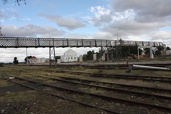


In the heyday of railways in South Africa, Klipplaat was an important railway junction, being the point at which the main Cape Town to Port Elizabeth line branched off towards Graaff-Reinet. The village grew up to house the railway facilities and the staff to man them.
Sadly those days have passed, the railway facilities closed, the railway employees, who were the core of the village's population, were either transferred or paid off and Klipplaat thereafter became a quiet little place.
Despite the lack of economic activity and the state of dereliction, Klipplaat is not without interest.
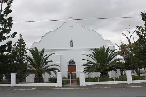
On entering the village from the Jansenville side, take the first street to the left and on the left hand side in the second block (33° 1' 5.65"S / 24° 20' 27.28" E) is the NG Church which might well be the best preserved building in the place.
Return to the main road and turn left. Just past the houses is a road off to the left (33° 1' 7.84" S / 24° 20' 9.59" E) signed 'Loco Workshop'. If you enter this road it will take into the heart of the station and workshop area.
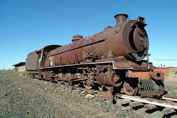
Return to the main road and turn left again. Just before the intersection with the R338 there stands on the left a derelict reminder of the age of steam which was the lifeblood of the village in its time. (33° 1'14.30"S / 24°20'5.74"E)
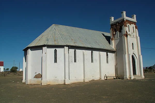
Turning left into the R338 you immediately see the little Anglican church on the right, now sadly dilapidated, and next to it the Methodist church.
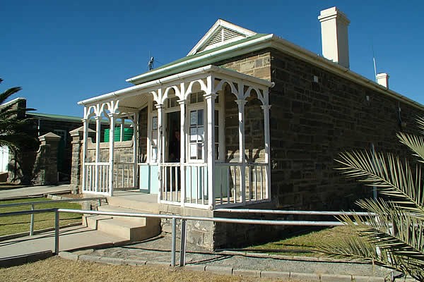
Return to the main road and turn left. The first building you come to on the left (33° 1' 16.84" S / 24° 19' 58.26" E) is the police station, still functioning, which is a quaint relic and once housed the local detachment of the Cape Mounted Police. Next door is the old magistracy, of the same vintage, which still functions once a week.
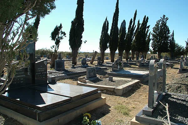
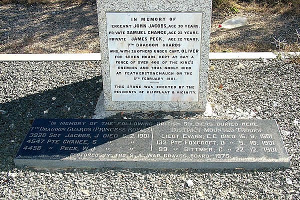
The village cemetery is a little way into the veld on the other side of the road (33° 1' 11.06" S / 24° 19' 58.65" E). Apart from giving an insight into the families who lived in Klipplaat, there is a memorial to some soldiers who died in a skirmish with a Commando near the village during the Anglo Boer War.
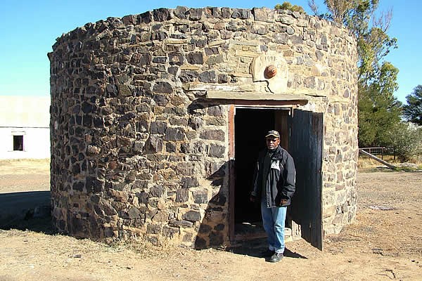
If you feel like a short drive, return to the R338 and turn towards Mount Stewart. A few kilometers outside Klipplaat (33° 4' 32.00" S / 24° 23' 24.37" E) the first farm on the right hand side, Hardwood, has in the yard two small curiosities. The first rondavel is in fact a magistracy and the second, behind it, looking like a small round pillbox is a lock-up. In days past, if stock thieves were caught they were confined in the lockup until the magistrate, on his travels round the district, arrived and held a trial.
Map and Directions to Klipplaat, near Jansenville
GPS : 33° 1' 13.71" S / 24° 20' 3.68" E
The road to Klipplaat, the R339, starts just south of the Sundays River bridge at the south end of Jansenville and goes straight to Klipplaat.
